 |
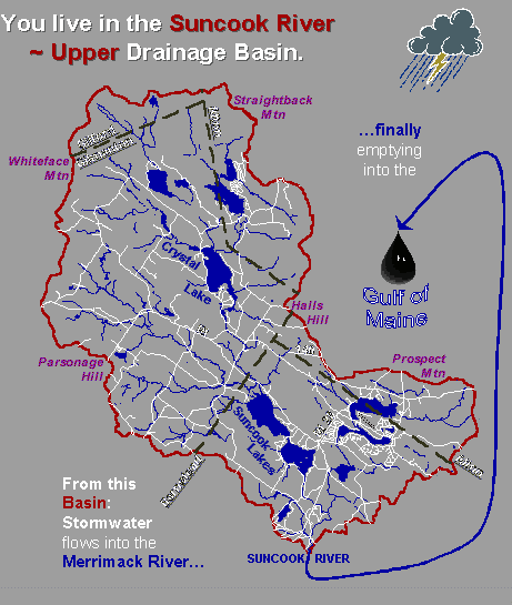
Upper Suncook River |
New Hampshire Friends of the
Suncook River
Suncook River Watershed
Click here to return to Watershed Page
Suncook River (SUN-kuk), c.35 mi/56 km long, S central N.H.; rises in ponds E of Gilmanton, SE central Belknap co.; flows S through Crystal L. and Upper and Lower Suncook lakes, then SW, past Pittsfield, receives Little Suncook R. from E at Epsom, flows to Merrimack R. at Suncook village, 6 mi/9.7 km SE of Concord.
|
Upper Suncook River |
Where is the Suncook River Watershed located?
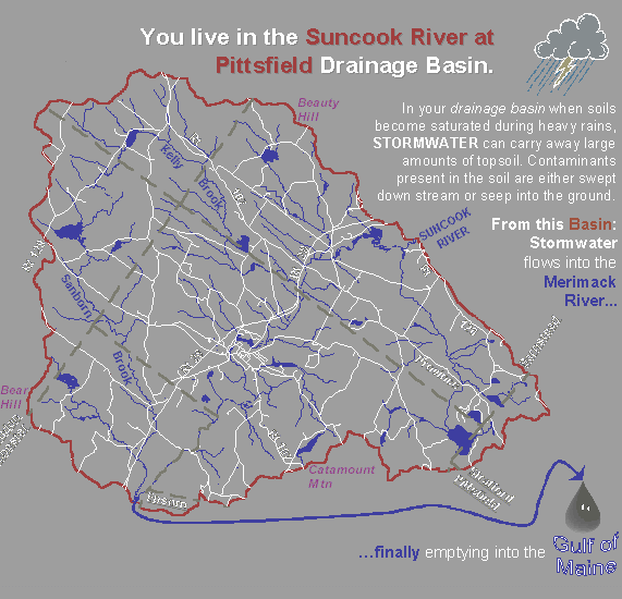
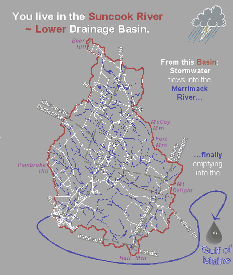
According to NH Department of Environmental Services, the Suncook River Watershed is actually composed of two watersheds: the Upper and Lower Suncook River Watersheds. These are two of over 200 sub-watersheds located within the state of New Hampshire. For our purposes, the two are considered as one.·
The Suncook River Watershed is considered a sub-watershed of the Merrimack River Watershed.·
The Merrimack River empties into the Gulf of Maine.·
The Merrimack River Watershed is considered a sub-watershed of the Gulf of Maine Watershed,·
and the Gulf of Maine is part of the Atlantic Ocean. Over 70% of New Hampshire drains into the Gulf of Maine Watershed.The highest point of the watershed is Round Pond, high in the Belknap Mountains in Gilford, NH.
According to Jewett, in the History of Barnstead, written in 1872, the Suncook River head watered in Gilford. “The drainage by the Suncook is so complete that it leaves no bogs or meadows to emit pestilence or to generate contagious disease.” (History of Barnstead, p.122) Today, according to DES Dam Bureau, the headwaters occur at Place’s Pond a.k.a. Sunset Lake which borders Alton and Gilmanton. Still other people maintain that Crystal Lake, a lake formed by the glaciers longs ago, are the true headwaters. The watershed itself exists in sixteen communities starting in the north with Gilford and Alton and ending in the south in Allenstown and Pembroke where the river empties into the Merrimack.
The Suncook River Watershed What is the significance of the Suncook River Watershed to the region? Early settlers first arrived in this region in the early to mid 1700s. They came primarily from the New Hampshire seacoast communities, Long Island, Rhode Island, and Massachusetts.By the time the first settlers arrived in this watershed, many of the Indians had left and gone north. They left behind the Indian name for the river: Suncook. It is believed that the name means “the place where the wild goose rested.” (History of Barnstead, p. 121)These settlers much like the Native Americans and the wildlife that were here prior to their arrival, used the river and its tributaries as a transportation corridor, as a food source, and later as a source of hydro power to run mills. Earliest dams built during the 1800s are still found in Gilmanton, Barnstead, Pittsfield, Chichester, Allenstown, and Pembroke.The Suncook Valley Railroad operated from 1869 through 1952. The old rail beds were laid alongside the river and can still be seen today although abandoned. The railroad ran from Suncook to Center Barnstead.
This Page Last Updated
October 17, 2019